| Bloomington, IN |
Biking & Walking |
closed |
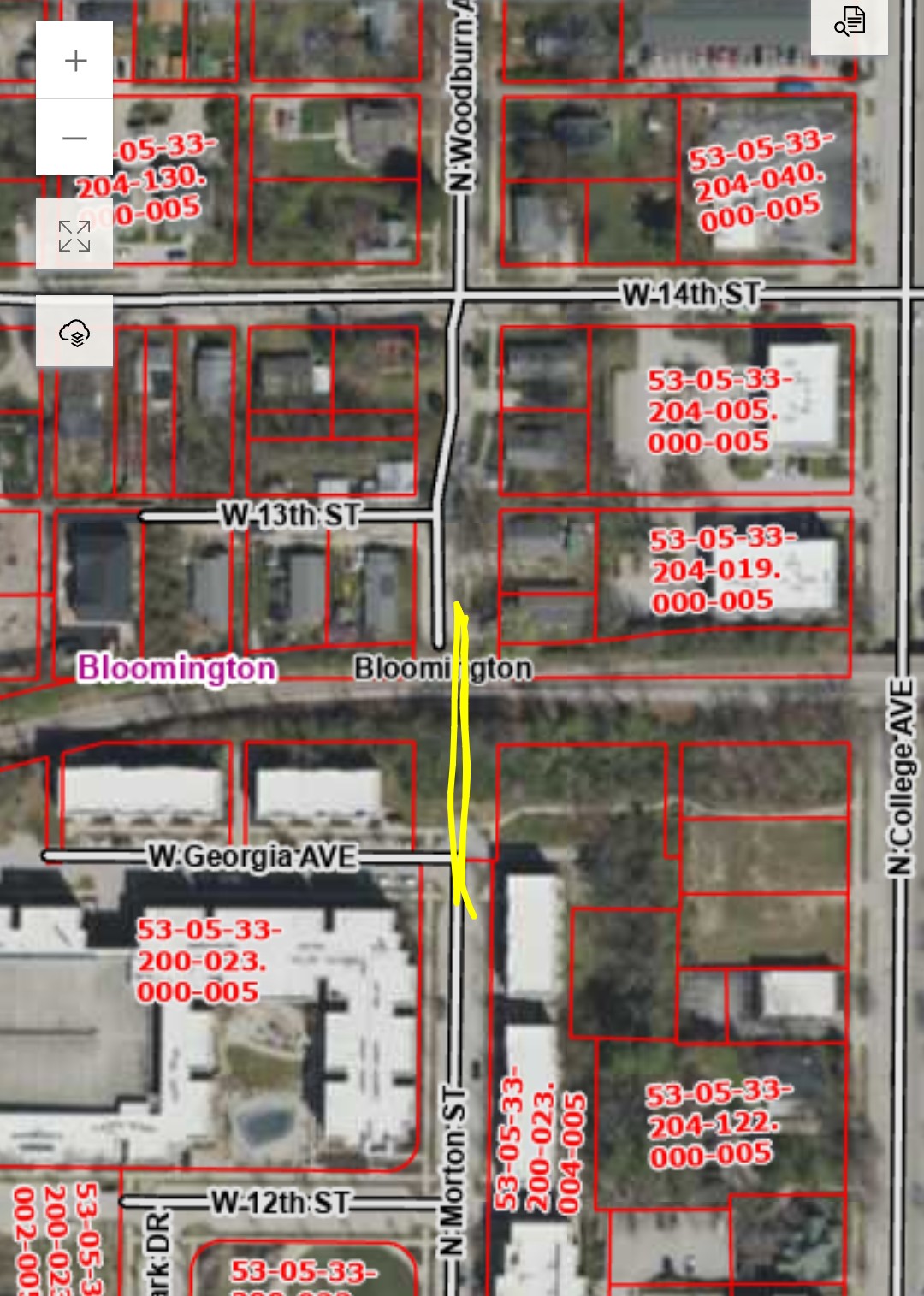
Can the city connect N.Morton St to N.Woodburn, with a pedestrian bridge over the railroad?
In the next transportation plan update, can Woodburn be deemed a neighborhood greenway? |
|
3 months ago |
| Bloomington, IN |
Biking & Walking |
closed |
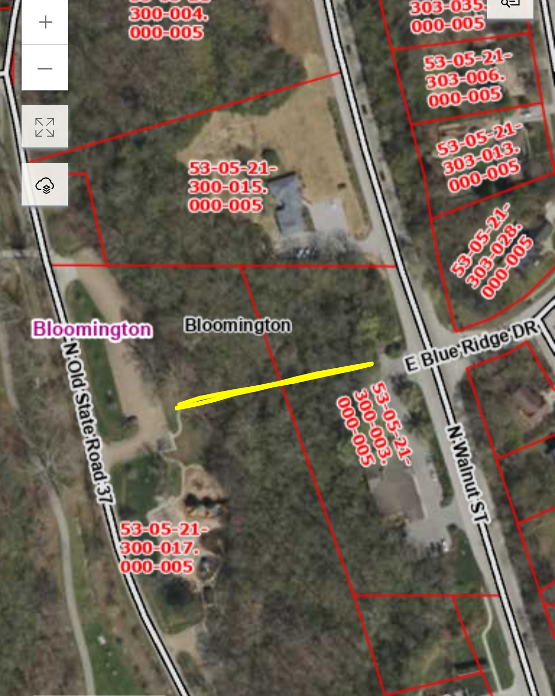
Can the city connect Blue Ridge Dr and the Visitor Center to the lower cascades playground parking lot? I'm asking this one for a friend, her vision was a grand staircase, more of an art object than a bike trail. |
|
3 months ago |
| Bloomington, IN |
Biking & Walking |
closed |
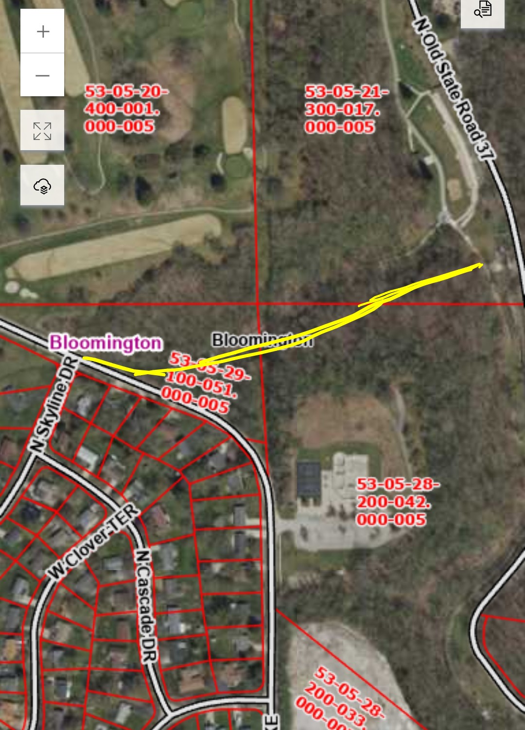
Can the city connect N.Old SR 37 to N. Skyline Dr? There is an old roadbed parallel to and south of the waterfall in Cascades Park and it's creek, with a yellow gate by the small pedestrian bridge by the lil circle thingy.
Crossing N.Kinser near the basketball courts/ skatepark can be a little daunting with the poor sightline of the curve. I suspect a crosswalk further west at Skyline Dr may feel safer. |
|
3 months ago |
| Bloomington, IN |
Trails |
closed |
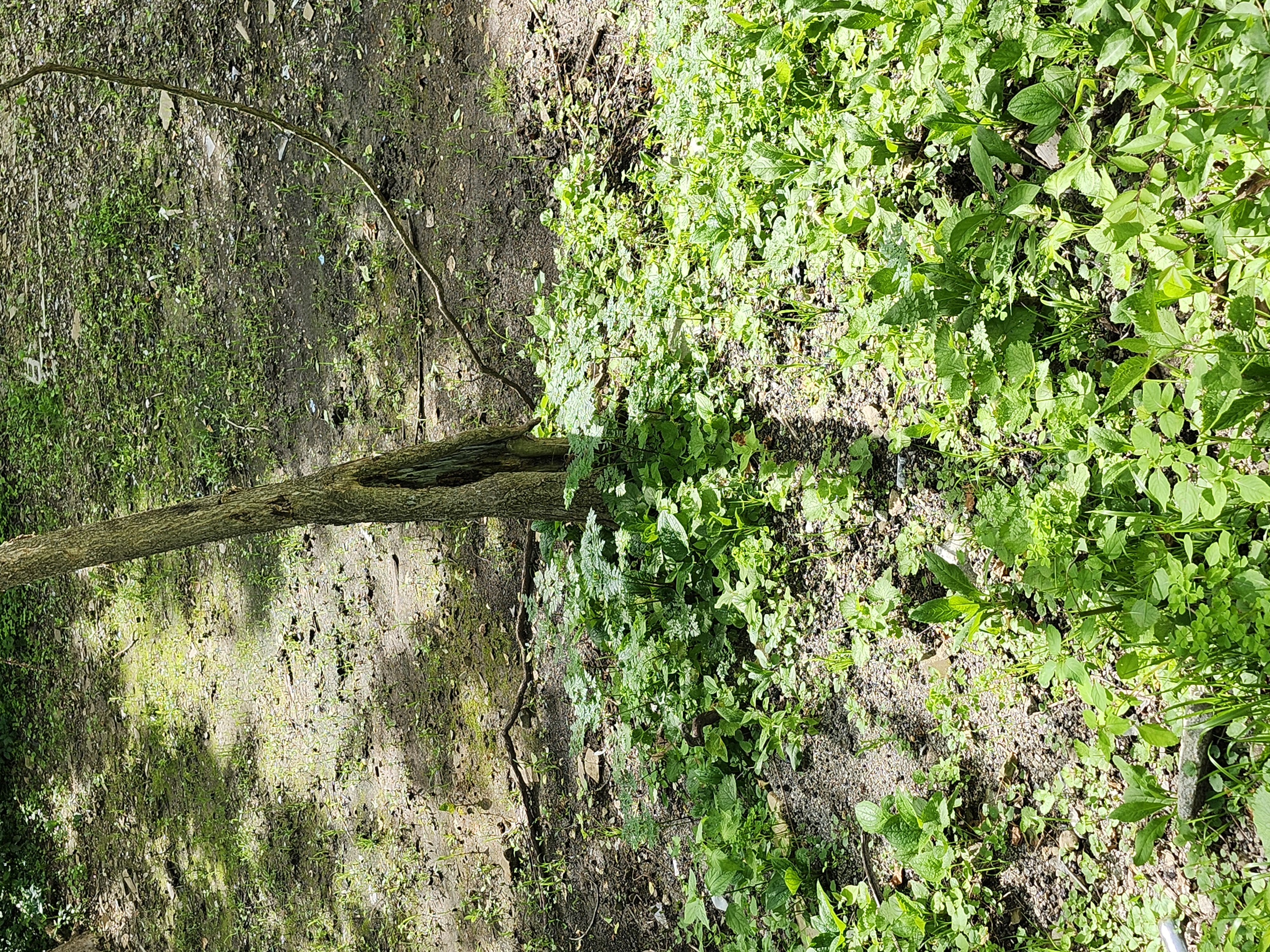
Poison Hemlock spotted by base of tree in area that was cleared of the old foundation on the BRT. Easiest access is from New Spur trail |
|
3 months ago |
| Bloomington, IN |
Parks & Playgrounds |
closed |
Loud obnoxious and profanity laced music is being played in the park—Saturday at 5:30 pm |
|
3 months ago |
| Bloomington, IN |
Biking & Walking |
closed |
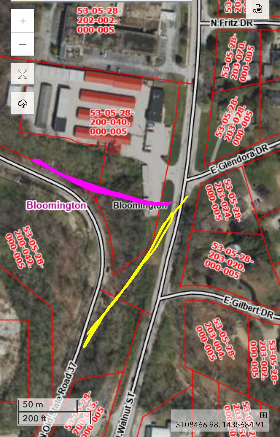
Can the city connect E.Glendora Dr to Old SR 37, by the site of the old motorcycle shop? I assume it would include a sidewalk to Cascades Inn and crosswalks across N.Walnut and N. Dunn. |
|
3 months ago |
| Bloomington, IN |
Trails |
open |
A large tree is down in Jackson Creek under the bridge at East Rhorer road. This is the branch of Jackson Creek to the west of Sare Road. Thank you so much! |
|
3 months ago |
| Bloomington, IN |
Biking & Walking |
closed |
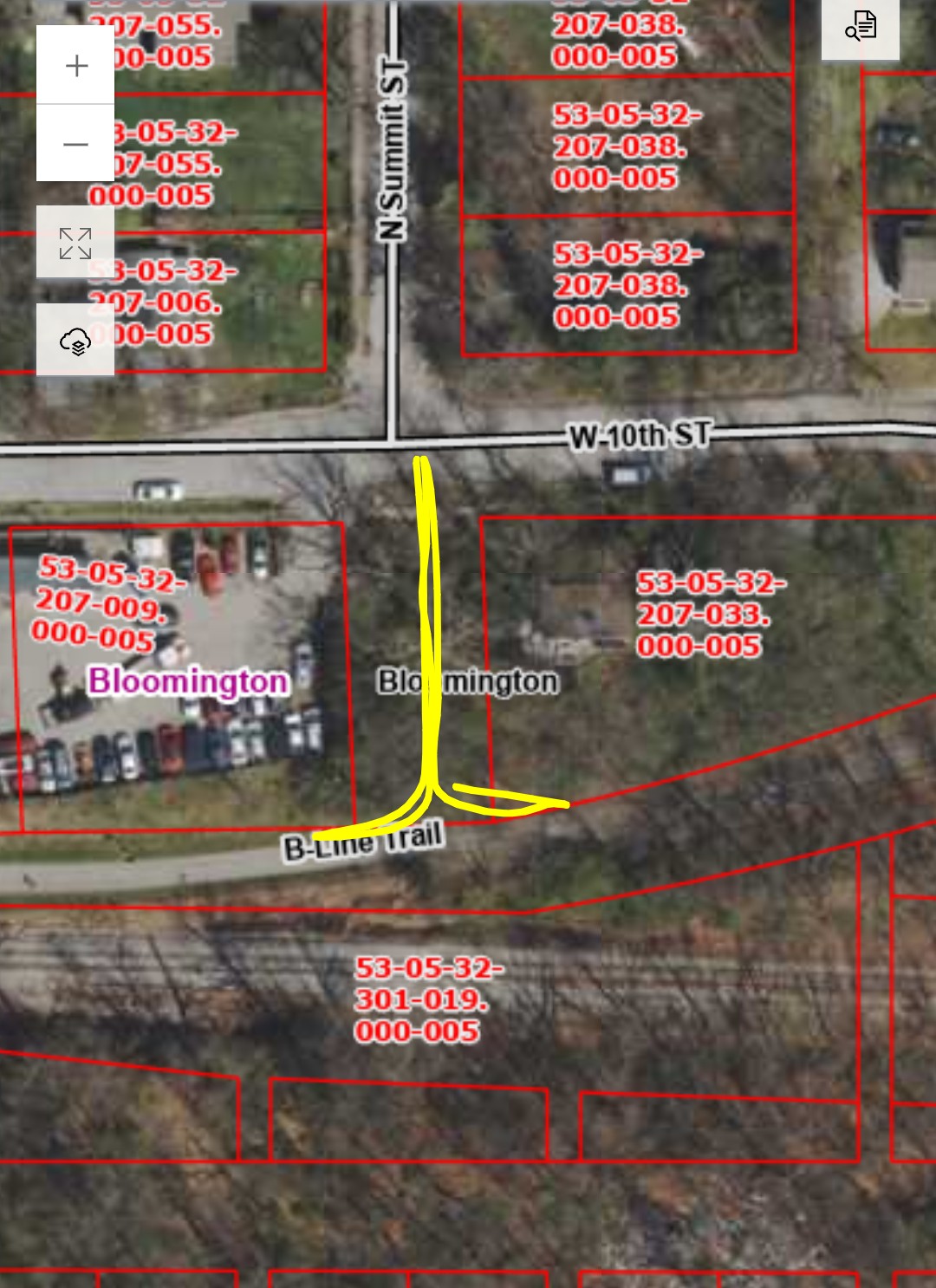
Can the city connect the B-Line to N.Summit St? There is a user path, with exposed bedrock. I believe the elevation ~11'. |
|
3 months ago |
| Bloomington, IN |
Biking & Walking |
closed |
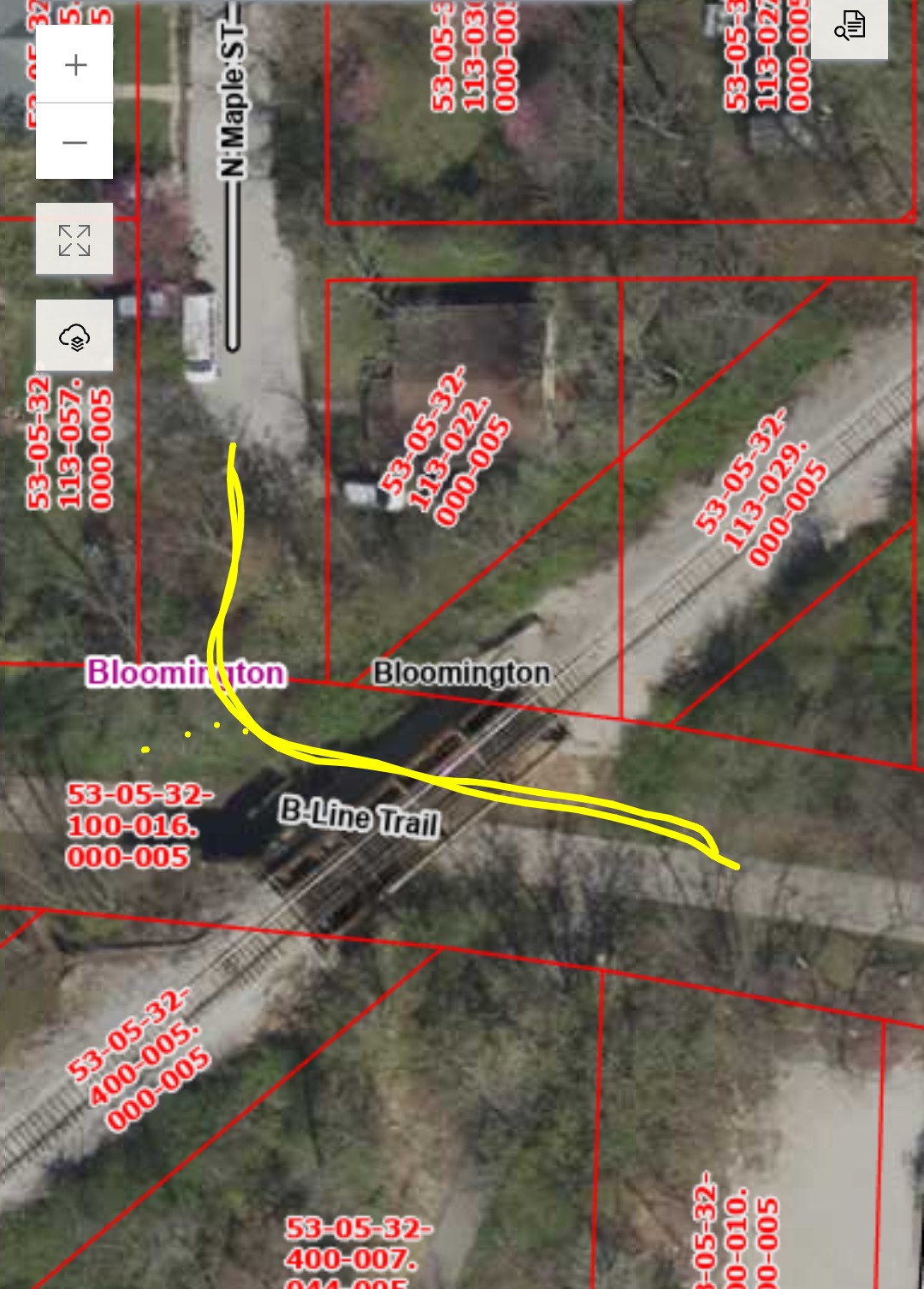
Can the city connect the B-Line to N.Maple St, a neighborhood greenway? There is a user path, with exposed limestone bedrock. Guessing the elevation is ~14'. I believe there is space in the B-Line ROW for a ramp. |
|
3 months ago |
| Bloomington, IN |
Parking Meters and Citations |
closed |
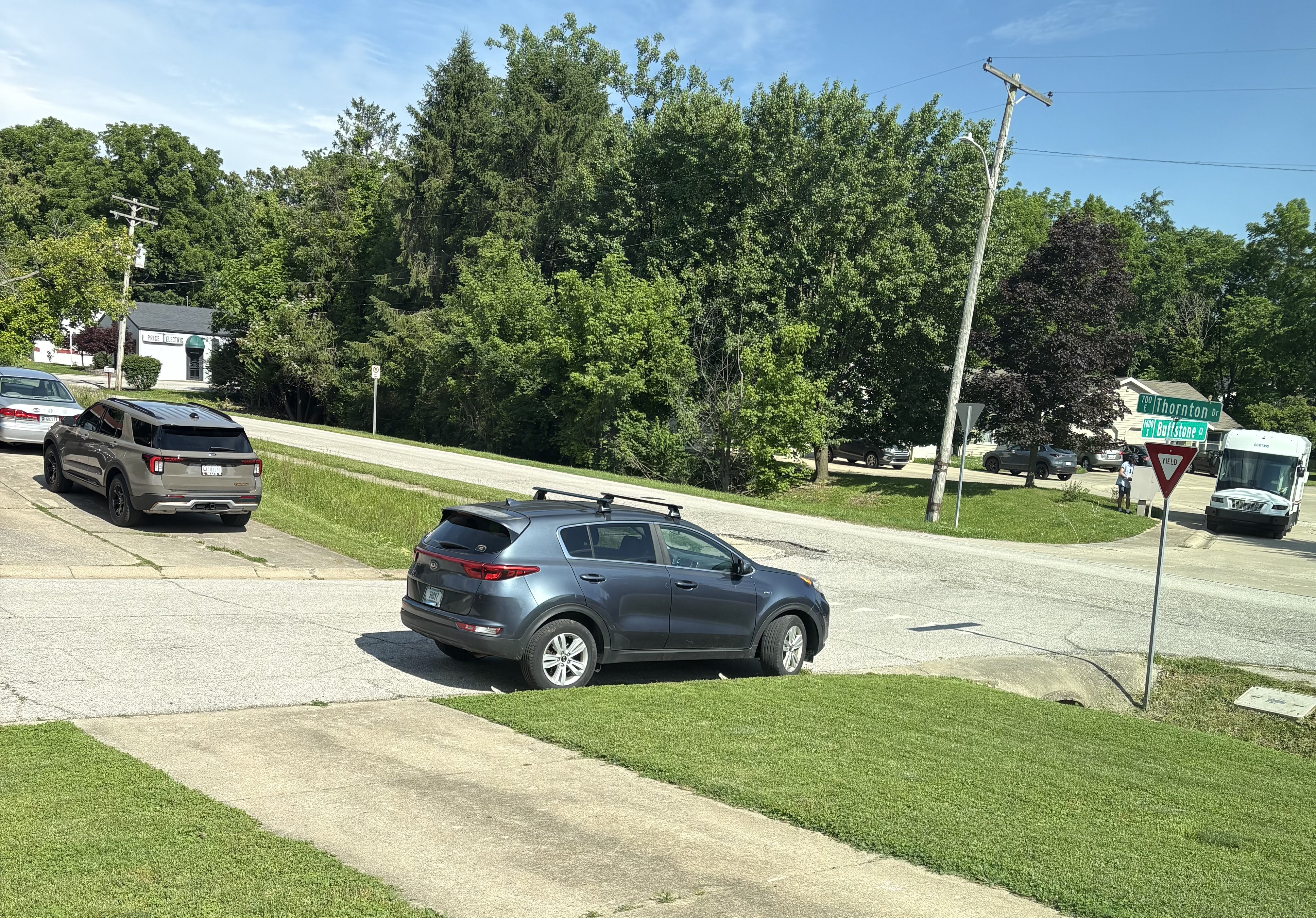
Cars keep parking in front of this yield sign. It makes it difficult to see when pulling out. |
|
3 months ago |